Researchers in Iran have used digital elevation models to improve the accuracy of solar energy potential maps. Their model aims to identify the best areas for solar panel deployment in urban areas.
Researchers from the University of Isfahan in Iran claim to have improved the precision of digital elevation models (DEMs) in creating high-resolution annual solar energy potential maps.
DEMs are 3D images of the bare Earth’s surface of land, shown without trees, buildings, or other objects. In terms of their application in creating solar energy maps, these images take into account elevation, slope, aspect and shadow effects, among other things. DEMs such as SRTM, ALOS, ASTER and Copernicus are available online as open access tools and are currently widely used to generate solar maps.
“Thanks to their extensive spatial coverage, they enable the production of solar energy potential maps in most less developed areas, at a lower cost,” the scientists explained. “However, the low resolution of these DEMs compared to those obtained from LiDAR data reduces the accuracy of extracting maps of solar potential, which poses limitations for the precise location placement of solar panels, especially in urban areas and in the area of highways,” she added. noting that the LiDAR method, which measures distances by using a laser on a target, has high costs and significant storage requirements.
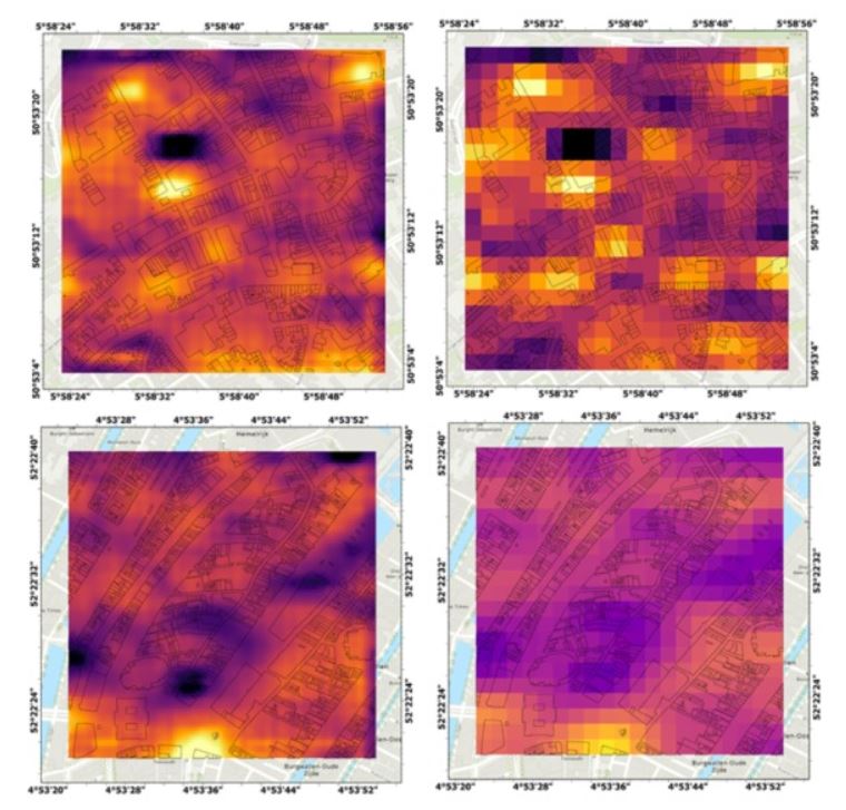
The research group proposed to overcome these limitations by using deep learning networks to improve the resolution of DEMs. The work mainly consisted of training the DEMs to improve the spatial resolutions of the solar energy maps and identify the best areas for deploying solar panels in urban areas.
Image: University of Isfahan, Helyion, Common License CC BY 4.0
The academics used the enhanced deep super-resolution network (EDSR) to improve the resolution of the LiDAR-derived solar map. The EDSR is a convolutional neural network suitable for improving the spatial resolution of images and widely used in computer vision tasks.
The performance of this network in improving the accuracy of the generated solar energy maps was compared with that of the U-Net network, a convolutional network technique used for fast and accurate segmentation of images.
The scientists found that the EDSR model was the most accurate and stable at improving the accuracy of solar potential maps. They then used the model to improve the resolution of a Copernicus DEM-derived solar energy potential map from 30 m to 6 m.
“A comparative analysis between the Copernicus DEM-based map and the EDSR-enhanced map, using a LiDAR-based reference, showed that the EDSR model not only improved the resolution of the map, but also the accuracy of the estimate of solar energy improved, especially in urban areas and along major highways,” the research team emphasized. “Finally, the enhanced 6 meter resolution map was assessed for its effectiveness in identifying suitable buildings for solar panel installation.”
The details of the modeling are available in the paper “Improving the resolution of solar potential maps derived from global DSMs for rooftop solar deployment using deep learning”, published in Helyion.
This content is copyrighted and may not be reused. If you would like to collaborate with us and reuse some of our content, please contact: editors@pv-magazine.com.
Popular content


