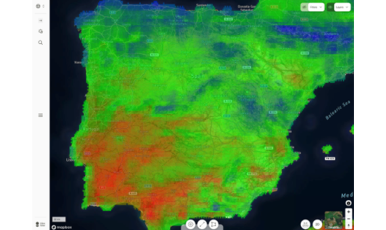
The Norwegian PV planning software company said it has added the new PV degradation maps to pinpoint site locations with favorable climatic conditions.
Norway’s Glint Solar, a developer of software for large-scale solar developers, has developed a new module that maps the variability of PV degradation across Europe and provides useful planning information to project developers.
“The map module pinpoints regions with minimal PV degradation, revealing variations even within countries. End users can simply click on a point on the map and receive a numerical score of two decimal places between 0 and 10, corresponding to the severity of the site’s degradation,” shared co-founder and Chief Commercial Officer Even J. Kvelland. pv magazine.
It was completed in collaboration with the Norwegian Institute of Energy Technology (IFE) and is based on two studies on modeling the impact of combined climate loads on the maximum power of the module, namely “Global climate data processing and mapping degradation mechanisms,” published in Energies, And “Modeling the lifetime of outdoor PV modules: effects of combined climate stressors on PV module performance degradation,” published in IEEE Journal of Photovoltaics.
The degradation calculation takes into account several climate-related stressors, including hydrolysis, that is, stress due to relative humidity and temperature, photodegradation caused by high UV radiation, and thermomechanical stress mainly caused by rapid temperature fluctuations.
Solar developers can use it to make informed comparisons of locations. “This type of information is important for developers in the early phase of a project, as it provides valuable site-specific knowledge to developers for, for example, preliminary project size,” says Kvelland, adding that location decisions can be made with the “highest chance of success.” receive permit approval and ultimately be built.
The mapping module is part of the cloud-based software Glint Solar for identifying suitable locations for solar farms, taking into account parameters such as distance from the electricity grid or substations, topography, soil depth and solar radiation.
Founded in 2020, Glint Solar provides relevant Geographic Information System (GIS) data, analysis tools, design capabilities and project overview tools for PV developers, optimizing and expanding their pipelines.
This content is copyrighted and may not be reused. If you would like to collaborate with us and reuse some of our content, please contact: editors@pv-magazine.com.


