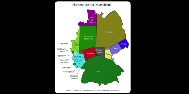
The visualization of land use brings some surprises
Image: Christian Victor, @cvictordus
A surprising map of Germany is currently circulating on the internet. The map, published by X (formerly Twitter) user Christian Victor, shows the country’s land consumption based on different types of surface use.
In addition to large areas for livestock feed, forests and vegetable crops, there are many more smaller areas, some of which are surprisingly small. For example, golf courses and open-pit mines currently take up more space than solar farms and wind energy systems combined. The areas currently covered by large-scale solar photovoltaics are approximately equivalent to the area under Christmas tree cultivation in Germany and are smaller than those covered by golf courses.
Victor said he will submit the exact list of sources at an unspecified later stage, but noted that most of the data comes from Germany’s Federal Statistical Office (Destatis) and the Federal Environment Agency.
This content is copyrighted and may not be reused. If you would like to collaborate with us and reuse some of our content, please contact: editors@pv-magazine.com.


